

-
TO START: Watch the video about Wegener by clicking this link.
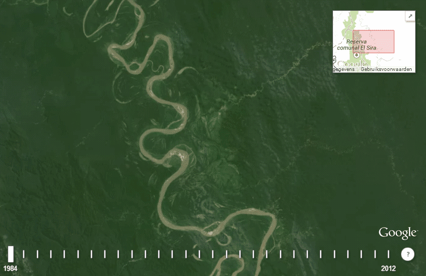
What evidence has been used to show that the continents have moved?
1. Continental Puzzle:
Wegener believed that all continents were once connected in one large landmass called Pangaea. When looking at maps he noticed that the edges of the continents fit together like puzzle pieces showing that they were once together. Take a look at the picture to the right and see how North America, South America, and Africa fit together. When the continents broke apart, they “drifted” to their present locations. Watch the video below to see how the continents moved over time.
CLICK HERE TO WATCH THE CONTINENTS DRIFT OVER TIME
(The video has music - please listen to it quietly. Thanks!)
2. Fossil Evidence:
Fossil remains of the same animals have been found in areas that are currently separated by large distances. For example, fossils of the reptile Mesosaurus have been found in South America and Africa. This swimming reptile lived in fresh water and on land. How could fossils of Mesosaurus be found so far apart? It is very unlikely that it could have traveled between the continents as they are today. Wegener thought this reptile lived on both continents when they were connected. The picture below shows 4 examples of organisms that lived on several continents that are now separated by thousands of miles!

Explore the website below to learn more about fossil evidence.
Continental Divide: The Breakup of Pangaea
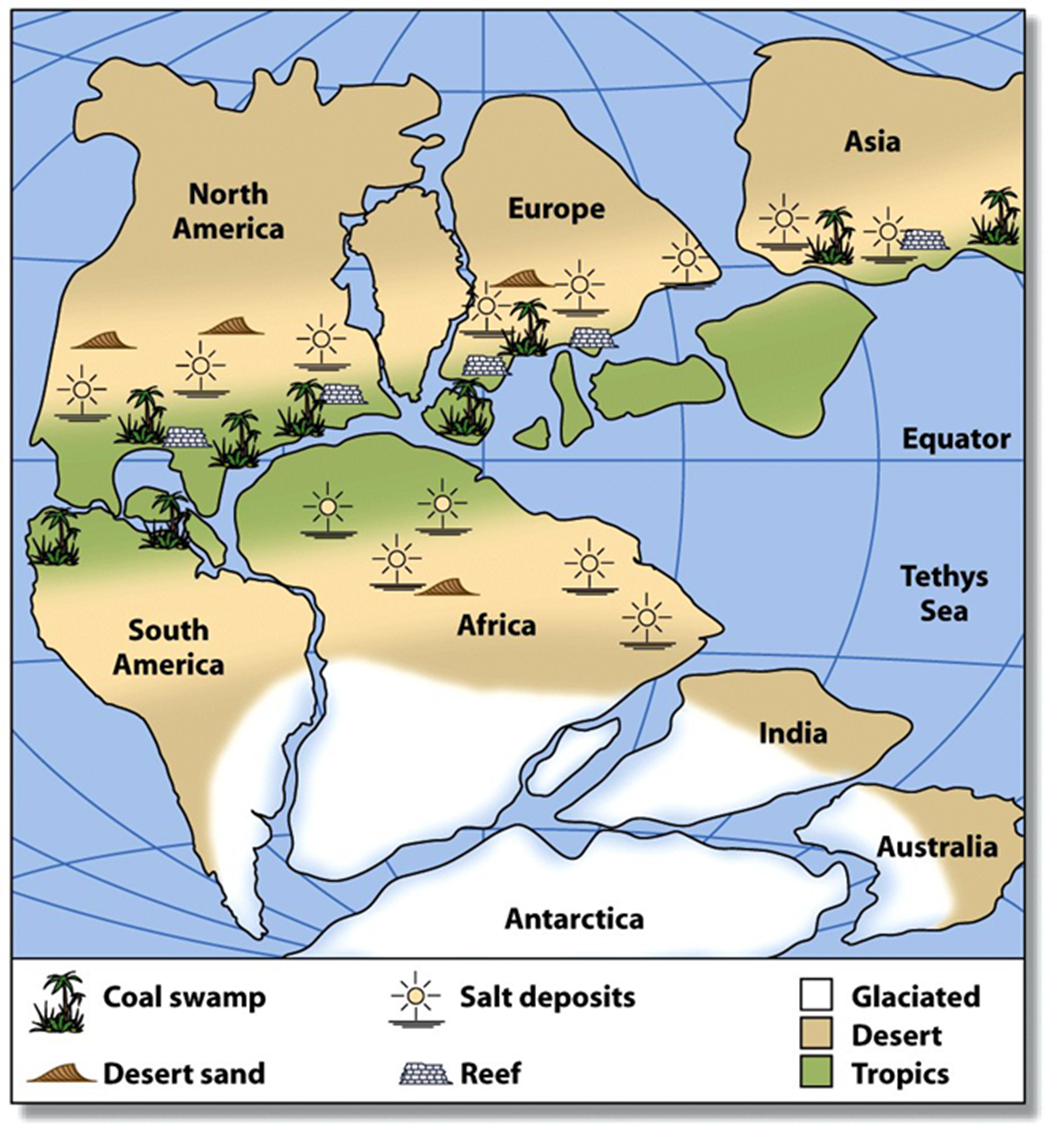
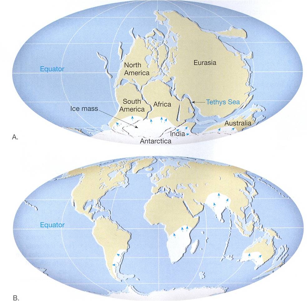
3. Climate evidence:
Fossils of warm weather plants were found on the island of Spitzbergen in the Arctic Ocean. Wegner believed that this island drifted from a tropical region to its current location. Also, glacial deposits and grooved bedrock found in southern areas of South America, Africa, India, and Australia indicate that these warm areas were once covered by glaciers. Wegener believed that these continents were once covered with ice near Earth’s South Pole and then moved to their current locations.
Click the links below to observe climate evidence including the locations and glaciation of South America, Africa, India and Australia 250 million years ago.
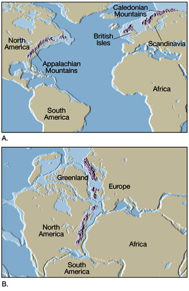
4. Rock Evidence:
If the continents were connected at one time, then rocks that make up the continents should show similarities. Similar rock structures are found on different continents. For example, parts of the Appalachian Mountains of the eastern United States are similar to those found in Greenland, Western Europe, and Africa. These mountains formed when North America collided with Europe and Africa as the continents drifted together to from Pangaea. Use the website below to view where these mountains were during the time of Pangaea.
YOU ARE DONE WITH THIS PART! DON'T FORGET TO SUMMARIZE THE 4 PIECES OF EVIDENCE FOR CONTINENTAL DRIFT IN YOUR HANDOUT.